

Since its establishment in the 40's, the CIA's Cartography Center is to inform the Agency, White House, senior policymakers, and the Intelligence Community with geographical analysis and instructive maps that are aesthetically pleasing and effective. The following are a selection of maps, one from each decade, that have been recently declassified and made accessible on the CIA's Flickr account.
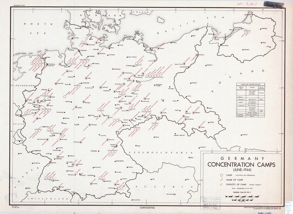 German Concentration Camps, 1944 (via CIA/Flickr)
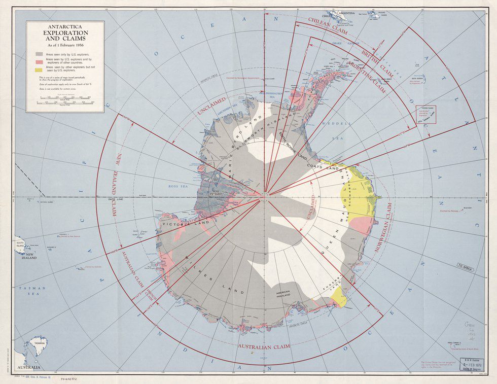 Antarctica Exploration and Claims, 1956 (via CIA/Flickr)
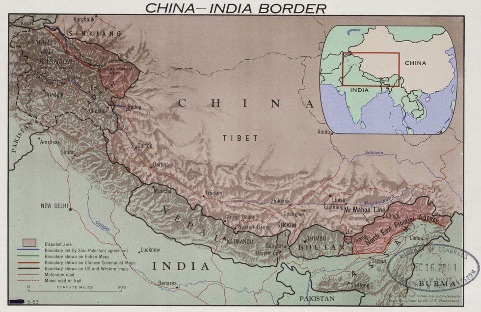 China-India Border, 1963 (via CIA/Flickr)
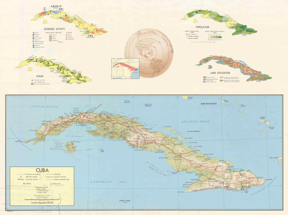 Cuba Country Profile, 1977 (via CIA/Flickr)
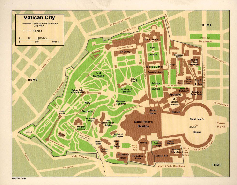
Vatican City, 1984 (via CIA/Flickr)
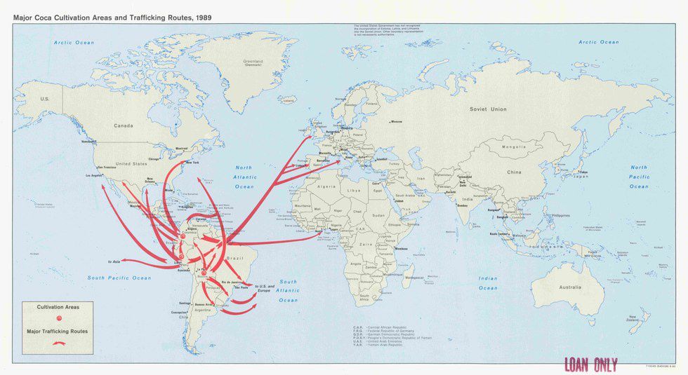 Major Coca Cultivation Areas and Trafficking Routes, 1989 (via CIA/Flickr)
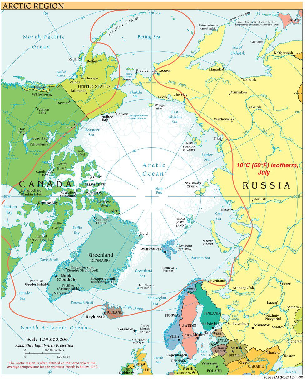 Arctic Region, 2000 (via CIA/Flickr)
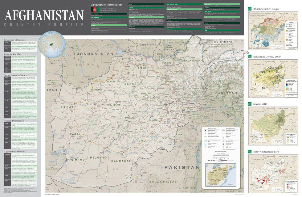 Afghanistan Country Profile, 2012 (via CIA/Flickr)
Additional articles on these CIA Cartography Center maps can be found on Hyperallergic and the CIA.